
價格:免費
更新日期:2019-04-18
檔案大小:177 MB
目前版本:1.3.1
版本需求:需要 iOS 9.0 或以上版本。與 iPhone、iPad 及 iPod touch 相容。
支援語言:英語

The Soil TopARgraphy phone app allows users to view topographical distribution of different soil types through an Augmented Reality (AR) terrain.
The app was developed to help students, in the UBC’s APBI 200 – Introduction to Soil Science course and other soil-related courses, learn about the effects of topography on the formation of different soil types in an immersive and visual manner.
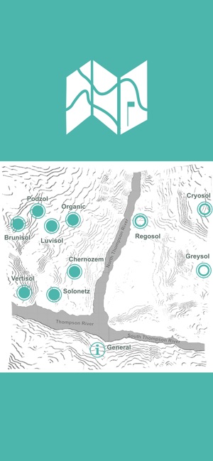
As a part of the curriculum, students in the APBI 200 course learn about 10 soil orders, where the soil order is the broadest classification category in the Canadian system of soil classification. The topics of soil formation and classification are of direct importance for land use and management. Hence, it is essential that our future land managers have a solid understanding of soil formation and factors – like topography – that drive it. These topics are currently covered in the APBI 200 course through a series of lectures, laboratory activities, video footage, web-based resources, and a couple campus-based field trips. However, there is still a need to enhance students’ learning on this important topic, which led to the development of the Soil TopARgraphy app which brought in visual and tactile elements to the learning experience.
Augmented Reality (AR) is a technology that overlays digital enhancements on top of existing reality, in this case through your phone. With AR, different soil orders are shown within one real-life terrain across different parts of topography. We chose an area just north of Kamloops, British Columbia as an example of the terrain model since the region is characterized by a great diversity of soil types.
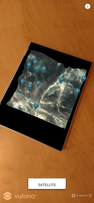
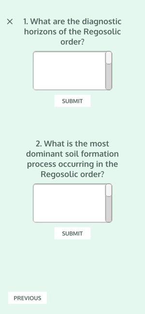
With the Soil TopARgraphy app, which allows viewing and manipulating a terrain model, students will learn how topography impacts the distribution of soil orders through its effects on microclimate (i.e. temperature and water). Students will be able to view the terrain model with a color-coded elevation map or a satellite image. Furthermore, students can tap on flags to read about different soil orders, view images, and take a self-study quiz to reinforce their understanding.
Soil TopARgraphy was developed at the UBC Emerging Media Lab by:
Faculty:
- Dr. Maja Krzic, Faculty of Forestry | Faculty of Land and Food Systems

Students:
- Daphne Liu, Team Lead & Developer (Jan 2018 to present)
- Tiger Oakes, Developer (Mar 2018 to present)
- Emma Ng, UX/UI Designer (Mar 2018 to Apr 2018)
- Daanyaal Sobani, Developer (May 2018 to Aug 2018)
支援平台:iPhone, iPad